grid-01CONFIRMED
LCRA and Blue Fox executed the LLI-2421 Large Load Interconnection Study Agreement, with both parties signed by November 4, 2025. [1]
LCRA Large Load Interconnection Study Agreement (Oct 2025).pdf · PDF pp. 1, 15
 ASCENDENT
The source file behind the Kilo campus brief. Use it when you want the citation, the condition, and the next workstream.
 ASCENDENT
Keep source facts, planning scores, and commercial commitments in their proper roles.
This annex reproduces the authored campus file and its original document titles and page labels. Original PDF binaries were not in the extract we packaged; we do not recertify those originals here.[1]
ASCENDENTEach reference key identifies a specific layer in the retained source record.
Authored domain record
Kilo/Kerr claims, analyst notes and actions. Preferred presentation layer.MVP site bundle
Underlying structured document/claim register. Differing claims are retained separately.Stored readiness snapshot
Overall and seven category values, dated 2026-09-02. Explicitly hard-copied.Dataroom composition
The loader distinguishes source bundles, authored overlays and readiness.Ascendant preliminary schedule JSON
191 engines / 477.5 MW. A distinct supporting schedule, not the authored Phase 1 plan.Oasis summary JSON
Separate proposed commercial terms and an explicitly nonbinding generation inference.Descriptive gap assessment
Twelve-domain evidence counts; a different basis from the stored readiness score.Generic test bundle — excluded
The tenant-ready-test pack is not used as Kilo evidence.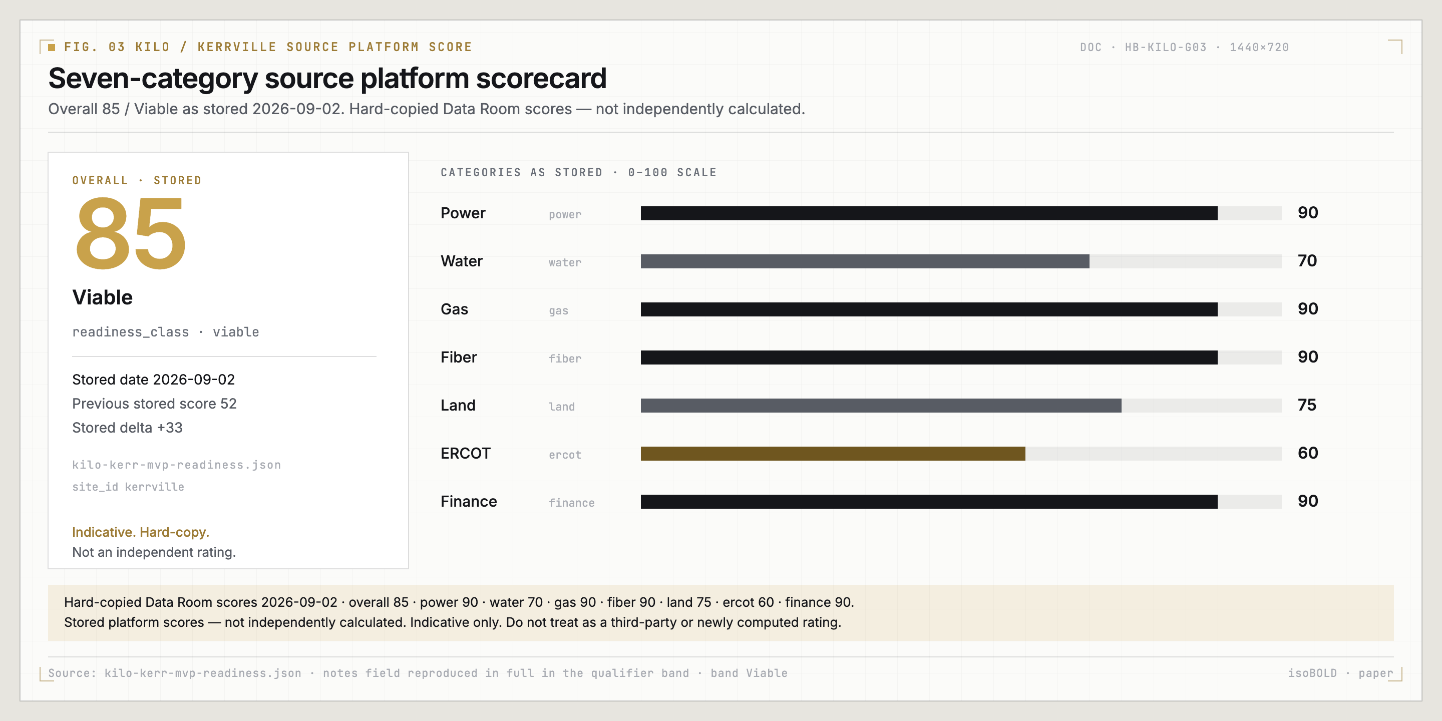 ASCENDENT
The complete source matrix is shown, including partial and missing-evidence categories.
| Domain | Covered | Partial | Not found | Source direction |
|---|---|---|---|---|
| Grid interconnection | 4 | 3 | 0 | Completion gaps |
| Natural gas | 0 | 5 | 0 | Completion gaps |
| Land title | 3 | 3 | 0 | Completion gaps |
| Transmission / substation | 2 | 3 | 0 | Completion gaps |
| Environmental / geotech | 2 | 3 | 1 | Completion gaps |
| Water | 1 | 2 | 2 | Evidence gaps |
| Fiber | 1 | 3 | 0 | Completion gaps |
| Access / site plan | 0 | 3 | 1 | Evidence gaps |
| Equipment / procurement | 1 | 3 | 0 | Completion gaps |
| Schedule | 3 | 0 | 1 | Completion gaps |
| Appraisal / finance | 0 | 1 | 3 | Evidence gaps |
| Permitting | 0 | 1 | 4 | Evidence gaps |
| Total descriptive evidence items | 17 | 30 | 12 | 59 items across the source matrix |
Completion gaps abbreviates the source direction ‘Meaningful evidence but material completion gaps’. Evidence gaps retains the source label. Counts are descriptive, not weighted readiness points or a new VDR completeness certification; the authored narrative may differ. [7]
ASCENDENTA documented utility development pathway at a 2,100 MW / 345 kV study basis.
LCRA and Blue Fox executed the LLI-2421 Large Load Interconnection Study Agreement, with both parties signed by November 4, 2025. [1]
The executed study scope evaluates a requested 2,100 MW load at 345 kV and treats April 1, 2028 only as a study-purpose energization date. [1]
PEC and Blue Fox executed a Transmission Facility Extension Agreement effective July 10, 2026, with construction and service contingent on studies, approvals, security, access rights, and other prerequisites. [1]
ERCOT-format surveys identify LLI-2421 Kerr Data Center, a 345 kV interconnection, and a planned 2,100 MW load whose detailed design remains incomplete. [1]
The PEC agreement records a planned ramp of 600 MW by December 31, 2030, 1,200 MW by December 31, 2031, and 2,100 MW by December 31, 2032. [1]
ASCENDENTDevelopment-stage grid position is materially advanced by executed LCRA and PEC instruments and a defined 2.1 GW study basis; final capacity and energization remain the next utility gate.
To advance from executed development agreements to firm capacity, the project must close issued studies, ERCOT and utility approvals, final upgrade scope, security, and energization authority. [1]
Electric-energy supply remains a separate commercial workstream because the PEC facility agreement does not itself supply power. [1]
Advance issued studies, approvals, upgrades, security, supply arrangements, and energization authority while preserving the planned 2.1 GW basis as a development target. [1]
Requested/studied capacity and executed development instruments, not a firm power award. Final studies, approvals, upgrades, security, electric supply and energization authority remain gates. April 1, 2028 is a study-purpose date; the later PEC ramp is conditional.
The observations and next action retain their authored source basis [1]. The complete descriptive counts are shown in the evidence matrix [7].
ASCENDENTGas origination and a preliminary phased BTM generation plan broaden the development options.
Kinder Morgan proposed firm transportation of up to 215,000 MMBtu per day to a new Kerr County delivery point for a 10-year term after meter in-service. [1]
The proposal contemplates a new lateral and interconnect, with receipt and delivery points still to be determined. [1]
A preliminary Phase 1 schedule plans 442 CAT G3520K engines totaling 1,105 MW through July 2029. [1]
ASCENDENTThe project has a credible gas origination and Phase 1 generation basis suitable for development planning; refreshed binding fuel, lateral, and plant agreements are the next commercial gate.
The next commercial gate is to refresh the expired discussion-stage proposal into binding supply and transportation terms with confirmed volume and credit support. [1]
The next execution gate is a surveyed and permitted lateral plus coordinated plant, EPC, OEM, emissions, and fuel-balance documentation. [1]
Refresh binding fuel and transportation terms and advance the lateral, plant, OEM, EPC, air-permit, and fuel-balance package. [1]
Origination/proposal and preliminary generation-planning evidence, not binding fuel, transportation, lateral, OEM or EPC commitments. The discussion-stage proposal needs refreshing; equipment and schedule are not guaranteed.
The observations and next action retain their authored source basis [1]. The complete descriptive counts are shown in the evidence matrix [7].
ASCENDENTRecorded deed and survey evidence underpin a 3,979.63-acre surveyed campus-scale opportunity.
A recorded special warranty deed conveys the described Kerr County property to Blue Fox Development, LLC. [1]
The deed describes 3,980.63 gross acres less a 1.00-acre exception and was recorded May 8, 2024 as Kerr County Document 24-02602. [1]
A title survey depicts a 3,979.63-acre tract and supplied record access, telephone, and water-related easements. [1]
The Phase I environmental assessment covers 24 adjoining parcels totaling approximately 4,005.86 acres. [1]
ASCENDENTRecorded deed and survey evidence provide a strong land-control basis for this stage; current title exceptions, mineral review, and acreage reconciliation remain closing work.
Before title close or corridor reliance, obtain the current title commitment, Schedule B instruments, mineral and lien review, and confirmation that access and utility rights serve the planned facilities. [1]
Reconcile the 3,979.63-acre survey, 4,005.86-acre Phase I scope, and 4,500-acre appraisal premise in one parcel crosswalk. [1]
Obtain current title exceptions and mineral review and reconcile deed, survey, Phase I, appraisal, tax, and KML acreage. [1]
A strong record-evidence basis, not completion of title-close diligence. Current title exceptions, minerals/liens, access and utility rights, and the deed/survey/ESA/appraisal acreage crosswalk still need reconciliation.
The observations and next action retain their authored source basis [1]. The complete descriptive counts are shown in the evidence matrix [7].
ASCENDENTPreliminary substation and corridor engineering give the next design stage a tangible starting point.
The LCRA study identifies two proposed points of interconnection on LCRA-owned Big Hill–Kendall 345 kV circuits. [1]
A 10% Kerr Data Center 1 package provides preliminary 345/34.5 kV single-line, general-arrangement, site-plan, and equipment information for a planned 1,050 MW net substation. [1]
A schematic plan shows a proposed 7.0-mile 345 kV path, one I-10 crossing, a midpoint PEC tie, and an on-site switchyard. [1]
ASCENDENTA 10% substation package and schematic 345 kV corridor are appropriate development-stage engineering; surveyed rights, crossing approval, and issued design are the next gate.
To move from 10% and schematic engineering to rights-ready design, obtain the surveyed route, endpoint reconciliation, easements, I-10 crossing approval, and utility acceptance. [1]
Issued design will require final one-line, protection, grounding, equipment, structure-spotting, and substation-site documentation. [1]
Survey the route, secure rights and crossing approval, reconcile endpoints, and complete utility-approved design. [1]
The 10% substation package and route schematic are preliminary engineering, not an issued utility-approved design or proof of secured rights, crossing approval, constructed facilities or available power.
The observations and next action retain their authored source basis [1]. The complete descriptive counts are shown in the evidence matrix [7].
ASCENDENTA Phase I contamination screen and slope mapping create a useful early design foundation.
A January 2026 ASTM E1527-21 Phase I assessment reported no recognized environmental conditions for its 4,005.86-acre, 24-parcel scope. [1]
Screening maps report 3,514.1 acres under a less-than-10-percent slope criterion and 3,109.4 acres under a less-than-5-percent criterion while avoiding mapped FEMA and wetland areas. [1]
A groundwater-prospecting report describes the surveyed area as primarily Edwards Limestone Formation. [1]
ASCENDENTThe Phase I closes the initial contamination-screening gate and terrain mapping supports layout studies; targeted field and design investigations are the next stage.
The next design gate is targeted geotechnical and karst investigation for halls, power facilities, roads, substations, and utility corridors. [1]
Field wetlands and waters, parcel-specific flood and drainage, species, cultural, air, and noise work should be completed as layout and permitting mature. [1]
Focus the next program on geotechnical and karst conditions, wetlands and waters, flood and drainage, and generation-related air and noise constraints. [1]
No RECs is the source Phase I contamination-screen result, not comprehensive environmental clearance. Slope-screened areas are screening outputs, not engineered net buildable acreage. Field geotechnical/karst, wetlands/waters, flood, cultural, species, air and noise work remain.
The observations and next action retain their authored source basis [1]. The complete descriptive counts are shown in the evidence matrix [7].
ASCENDENTExisting well-quality testing and a targeted prospecting program define the next source-development steps.
A certified laboratory tested a December 18, 2025 sample from HGCD Well 3999 and reported no E. coli or total coliforms. [1]
The same sample reported hardness of 576 mg/L, sulfate of 380 mg/L, and total dissolved solids of 801 mg/L. [1]
A March 2024 seismoelectric survey tested 24 locations and interpreted potential groundwater at 18 locations. [1]
Target 4CJ1 was assigned an interpreted 100–180 gpm yield category and a maximum interpreted depth of 540 feet, subject to drilling and testing. [1]
ASCENDENTExisting testing and a 24-location groundwater program establish a credible source-development pathway; drilling, pumping tests, rights, and the campus balance are the next gate.
To advance interpreted targets into a bankable source, drill priority wells and complete extended pumping, drought, interference, quality, rights, and permit work. [1]
A phase-level water and wastewater balance is needed to size treatment, storage, redundancy, discharge, and reuse infrastructure. [1]
Drill and test priority targets, establish rights and permits, and complete the phased water and wastewater balance. [1]
A sample-quality result and interpreted prospecting targets do not establish sustainable yield, water rights, permits or a bankable cooling supply. Drilling/pumping/interference/drought tests and a phased campus water/wastewater balance remain.
The observations and next action retain their authored source basis [1]. The complete descriptive counts are shown in the evidence matrix [7].
ASCENDENTDocumented backbone adjacency provides a clear starting point for carrier and route negotiations.
The Kerr Summary represents an existing LCRA 48-strand backbone approximately 0.11 mile, or 600 feet, from the northern site boundary. [1]
The report represents 400 Gbps capability and nearby access points STR-440 and STR-442 at approximately 0.50 and 0.74 mile. [1]
An optional Edison diversity path approximately three miles north is described as a planned second-direction concept. [1]
ASCENDENTDocumented backbone adjacency and carrier engagement make high-capacity connectivity commercially plausible; allocation, laterals, service terms, and physical diversity remain to be closed.
The next commercial gate is written strand or wavelength allocation, service or IRU terms, endpoints, latency, service levels, price, and delivery date. [1]
The next construction and resiliency gate is a surveyed on-parcel lateral with rights and proof of two end-to-end physically diverse routes. [1]
Close allocation and commercial terms, survey and secure the lateral, validate latency, and document physical diversity. [1]
Backbone proximity, capability and carrier engagement are represented in the source report. Allocation, service/IRU terms, on-parcel laterals, latency and physically diverse end-to-end routes are not established as contracted service.
The observations and next action retain their authored source basis [1]. The complete descriptive counts are shown in the evidence matrix [7].
ASCENDENTRecorded access evidence and conceptual site geometry support coordinated campus planning.
The deed describes a 60-foot-wide, 16.33-acre YO Ranch Road strip. [1]
The title survey depicts a 60-foot private-access easement. [1]
Conceptual planning evidence includes five KML polygons, a six-hall schematic, and slope-screened buildable-area maps. [1]
ASCENDENTRecorded access instruments and conceptual site geometry support current site planning; heavy-haul validation, grading and drainage, and an integrated master plan are the next gate.
Before construction logistics are fixed, reconcile legal and physical access and validate heavy-haul, traffic, emergency circulation, and required road approvals. [1]
The next design gate is an engineered phased master plan integrating grading, drainage, stormwater, roads, halls, and all utility corridors. [1]
Reconcile legal access and complete heavy-haul, emergency access, grading, drainage, stormwater, and integrated corridor design. [1]
Recorded access and conceptual geometry support planning, not a final logistics, drainage, grading or utility master plan. Rights, heavy-haul/emergency access and approvals require reconciliation.
The observations and next action retain their authored source basis [1]. The complete descriptive counts are shown in the evidence matrix [7].
ASCENDENTEarly technical specifications and procurement references frame a focused vendor diligence program.
The 10% substation package includes preliminary quantities and specifications for major breakers, disconnects, and transformers. [1]
The preliminary Phase 1 schedule plans 442 CAT G3520K engines totaling 1,105 MW, with deliveries from April 2027 through July 2029. [1]
The PEC agreement references a superseded March 31, 2026 long-lead materials procurement agreement and prior payments, but equipment and amounts are redacted. [1]
ASCENDENTPreliminary equipment definition, delivery planning, and a referenced long-lead procurement arrangement support a credible sourcing pathway; unredacted vendor commitments remain to be closed.
To convert the sourcing plan into committed availability, provide unredacted OEM, EPC, purchase-order, deposit, manufacturing-slot, pricing, and vendor-schedule evidence. [1]
Final technical, acceptance, warranty, spares, service, heavy-haul, and storage plans should close with design and site readiness. [1]
Provide unredacted vendor and EPC commitments, slot and payment evidence, final specifications, acceptance plans, and logistics. [1]
Preliminary equipment definition and referenced/redacted procurement arrangements do not prove committed manufacturing slots or vendor availability. Unredacted OEM/EPC/PO, deposit, acceptance and logistics evidence remain.
The observations and next action retain their authored source basis [1]. The complete descriptive counts are shown in the evidence matrix [7].
ASCENDENTMultiple detailed workstream schedules provide the ingredients for an integrated delivery baseline.
A preliminary Phase 1 schedule runs from May 15, 2026 through November 30, 2029 and shows first 40 MW substantial completion on June 14, 2027. [1]
The ERCOT dynamic survey targets April 1, 2028 grid energization and a staged load ramp through December 2029. [1]
The LCRA agreement provides tentative 150-day study blocks and a 210-day facility-development estimate subject to approvals and data dependencies. [1]
The later PEC agreement records a load commissioning plan beginning December 31, 2030 and reaching 2,100 MW by December 31, 2032. [1]
ASCENDENTMultiple detailed schedules demonstrate active planning and evolving phasing; one designated, statused baseline is needed before dates are represented as externally reliable.
Designate one statused and logic-linked master schedule that reconciles the 2027 BTM milestone, April 2028 grid target, and 2030–2032 PEC ramp. [1]
Before external date reliance, define first power, first load, energization, substantial completion, and ready-for-service and tie them to utility, permit, fuel, procurement, and commissioning gates. [1]
Reconcile workstream dates and milestone definitions into one statused baseline with dependencies, critical path, and contingency. [1]
Dates and MW are source planning milestones, not externally reliable ready-for-service commitments. Reconcile BTM, grid-target and PEC dates in a statused logic-linked master schedule with milestone definitions and conditions.
The observations and next action retain their authored source basis [1]. The complete descriptive counts are shown in the evidence matrix [7].
ASCENDENTCommercial reference material exists; the next stage is a reconciled value and capital plan.
Colliers issued a December 12, 2025 as-is fee-simple valuation opinion of $3.92 billion for a 4,500-acre premise. [1]
The appraisal assumes correct client mapping and full entitlement for heavy electric and natural-gas development and was prepared without a property inspection. [1]
ASCENDENTThe Colliers appraisal supports development-stage commercial discussions as an assumption-based benchmark; capital commitments and a reconciled project model remain later-stage gates.
Before investment reliance, reconcile the appraisal with current title acreage, entitlement, infrastructure maturity, and scenario-based development costs. [1]
Later-stage financing work should provide the project model, sources and uses, capital stack, sponsor support, incentives, commitments, and downside sensitivities. [1]
Update the valuation basis for title and infrastructure maturity and provide the phased budget, capital plan, incentives, commitments, and downside cases. [1]
Assumption-based valuation on a different acreage premise, not a current independently verified market value, financing commitment or collateral opinion. Full-entitlement/mapping assumptions and no-inspection limitation remain material.
The observations and next action retain their authored source basis [1]. The complete descriptive counts are shown in the evidence matrix [7].
ASCENDENTAn identifiable jurisdictional and agency pathway can be converted into a managed approval program.
The appraisal states that the property is outside city limits and not regulated by a municipal planning or zoning authority, subject to the appraisal's limited zoning analysis. [1]
The preliminary Phase 1 schedule plans selection of an air-permitting firm and preparation and submission of a TCEQ air permit by November 26, 2026. [1]
ASCENDENTRural land-use context and scheduled TCEQ work support an identifiable permitting pathway; the permit register and priority applications remain the next formal gate.
The next formal gate is a complete permit register and status record covering air, water, stormwater, access, environmental, fire, pipeline, and utility approvals. [1]
The planned TCEQ work should be advanced with the application, emissions modeling, agency correspondence, public-notice plan, and issuance path. [1]
Create the permit register, advance priority applications, retain agency correspondence, and tie each approval to design and schedule gates. [1]
Rural location and a planned permitting workstream are not an exemption from all permits or evidence of approvals. Establish the complete register, status record, applications and agency path.
The observations and next action retain their authored source basis [1]. The complete descriptive counts are shown in the evidence matrix [7].
ASCENDENTDifferent source scopes and planning records are not silently combined into one commitment.
Authored 2,100 MW requested study basis with conditional development agreements.
Use the authored study and development-agreement basis for capacity discussions.
MVP 2,000 MW executed-IA wording; live overview legacy MW IA stat.
Sources: [1] [2]
Authored 442 CAT G3520K / 1,105 MW preliminary Phase 1 schedule.
Schedules remain separate pending a governing integrated baseline.
Separate Ascendant source JSON: 191 engines / 477.5 MW.
Sources: [1] [5]
Authored May 13 Kinder Morgan proposal with refreshed binding terms still needed.
The distinct commercial records require separate reconciliation.
Separate May 7 Oasis confirmation-summary/proposed terms and explicitly nonbinding MW inference.
Sources: [1] [6]
ASCENDENTDifferent source scopes and planning records are not silently combined into one commitment.
3,979.63-acre survey scope; retain exact scope label.
Survey, assessment and appraisal acreage retain their own source scopes.
3,980.63 gross deed acres less 1.00 exception; Phase I 4,005.86 acres/24 parcels; appraisal premise 4,500 acres.
Sources: [1]
Authored appraisal evidence with material assumptions and remaining finance gate.
The stored score does not establish financing maturity or an independent valuation.
Stored category finance90; static domain display50 and note saying appraisal not found.
Sources: [1] [3] [7]
Show all seven source categories and overall85 Viable dated2026-09-02 with hard-copy/indicative qualification.
Readiness scores and descriptive evidence counts remain distinct.
Static 12-domain display scores and 17/30/12 descriptive evidence counts use another basis.
Sources: [3] [7]
ASCENDENTDifferent source scopes and planning records are not silently combined into one commitment.
Actual bundle has 23 claim records.
The assembly count is not reconciled with the record count; this delivery uses the enumerated register.
Assembly metadata claims_lineaged=45.
Sources: [2]
ASCENDENTExact source-label strings from the authored record; multiple labels may refer to the same original document.
11) Wild_Horse_11x171.pdf · PDF p. 1
Record keys: tx-0311) Wild_Horse_11x171.pdf · p. 1; LLI-2421 Dynamic Load Survey · p. 4
Record keys: tx-m0114) Kerr Summary.pdf · PDF p. 1
Record keys: fiber-0114) Kerr Summary.pdf · PDF p. 5
Record keys: fiber-m0114) Kerr Summary.pdf · PDF pp. 1–3
Record keys: fiber-0214) Kerr Summary.pdf · PDF pp. 3–4
Record keys: fiber-0314) Kerr Summary.pdf · PDF pp. 4–5
Record keys: fiber-m025) WHR Survey · p. 1; Phase I ESA · p. 4; Colliers Appraisal · p. 25
Record keys: land-m02ASCENDENTExact source-label strings from the authored record; multiple labels may refer to the same original document.
5) WHR Survey.pdf · PDF p. 1
Record keys: land-03 · access-02Blue_Fox_Development_PEC_Transmission_FEA_20260710_redacted.pdf · PDF p. 1
Record keys: grid-05 · sched-04Blue_Fox_Development_PEC_Transmission_FEA_20260710_redacted.pdf · PDF p. 4
Record keys: equip-03Blue_Fox_Development_PEC_Transmission_FEA_20260710_redacted.pdf · PDF p. 7
Record keys: grid-m02Blue_Fox_Development_PEC_Transmission_FEA_20260710_redacted.pdf · PDF pp. 1–4
Record keys: grid-03Colliers Appraisal - Blue Fox (Dec 2025).pdf · PDF p. 29
Record keys: permit-01Colliers Appraisal - Blue Fox (Dec 2025).pdf · PDF pp. 5, 10, 13
Record keys: finance-02Colliers Appraisal - Blue Fox (Dec 2025).pdf · PDF pp. 5, 8
Record keys: finance-01ASCENDENTExact source-label strings from the authored record; multiple labels may refer to the same original document.
Colliers Appraisal - Blue Fox (Dec 2025).pdf · PDF pp. 5, 8, 10, 13
Record keys: finance-m01HGCD Water Well Testing Results - Trinity Well.pdf · PDF p. 1
Record keys: water-01HGCD Water Well Testing Results - Trinity Well.pdf · PDF pp. 1–2
Record keys: water-02Kerr County Gantt - 1.1GW Phase 1.pdf · PDF p. 1
Record keys: gas-03 · equip-02 · sched-01 · permit-02 · permit-m02Kerr Data Center 1 - 10% Substation Package.pdf · PDF p. 5
Record keys: equip-01Kerr Data Center 1 - 10% Substation Package.pdf · PDF pp. 1, 4–5
Record keys: tx-02Kerr Data Center 1 - 10% Substation Package; Kerr VOID synthesis
Record keys: tx-m02 · equip-m02Kerr VOID synthesis · appraisal_finance
Record keys: finance-m02ASCENDENTExact source-label strings from the authored record; multiple labels may refer to the same original document.
Kerr VOID synthesis · gas_supply_btm_generation
Record keys: gas-m02Kerr VOID synthesis · permitting
Record keys: permit-m01Kerr VOID synthesis · schedule
Record keys: sched-m02Kerr VOID synthesis · water
Record keys: water-m02LCRA Large Load Interconnection Study Agreement (Oct 2025).pdf · PDF p. 14
Record keys: sched-03LCRA Large Load Interconnection Study Agreement (Oct 2025).pdf · PDF p. 7
Record keys: tx-01LCRA Large Load Interconnection Study Agreement (Oct 2025).pdf · PDF pp. 1, 15
Record keys: grid-01LCRA Large Load Interconnection Study Agreement (Oct 2025).pdf · PDF pp. 6–8
Record keys: grid-02ASCENDENTExact source-label strings from the authored record; multiple labels may refer to the same original document.
LCRA Study Agreement; PEC Transmission FEA; Kerr VOID synthesis
Record keys: grid-m01LLI-2421 ERCOT Dynamic Load Survey (rev B).pdf · PDF pp. 1–2
Record keys: sched-02LLI-2421 Large Load Survey (rev 2).pdf · PDF pp. 1–2
Record keys: grid-04PEC Transmission FEA · p. 4; Phase 1 Gantt · p. 1
Record keys: equip-m01Petrolink-KMTP Kerr Proposed Term Sheet_2026.05.13.pdf · PDF p. 1
Record keys: gas-01 · gas-02 · gas-m01Phase 1 Gantt; Dynamic Load Survey; PEC Transmission FEA
Record keys: sched-m01Phase I Environmental Site Assessment (Jan 2026).pdf · PDF p. 4
Record keys: land-04 · geo-01 · geo-m02Phase I Environmental Site Assessment (Jan 2026).pdf · PDF p. 4; Kerr VOID synthesis
Record keys: geo-m01ASCENDENTExact source-label strings from the authored record; multiple labels may refer to the same original document.
WH Buildable Area 10% Slope.pdf · p. 1; WH Buildable Area 5% Slope.pdf · p. 1
Record keys: geo-02WHR Map.kml; 11) Wild_Horse_11x171.pdf · p. 1; WH Buildable Area maps · p. 1
Record keys: access-03WHR Map.kml; 11) Wild_Horse_11x171.pdf; slope maps
Record keys: access-m02Wild Horse Ranch Deed (3,996 ac).pdf · PDF p. 11
Record keys: access-01Wild Horse Ranch Deed (3,996 ac).pdf · PDF pp. 1, 13
Record keys: land-01Wild Horse Ranch Deed (3,996 ac).pdf · PDF pp. 3, 6, 13
Record keys: land-02Wild Horse Ranch Deed; 5) WHR Survey; Kerr VOID synthesis
Record keys: land-m01 · access-m01Wild Horse Ranch Seismic Survey - Final Report.pdf · PDF p. 4
Record keys: geo-03ASCENDENTExact source-label strings from the authored record; multiple labels may refer to the same original document.
Wild Horse Ranch Seismic Survey - Final Report.pdf · PDF pp. 4–6
Record keys: water-03Wild Horse Ranch Seismic Survey - Final Report.pdf · PDF pp. 6, 8
Record keys: water-04Wild Horse Ranch Seismic Survey - Final Report.pdf · PDF pp. 6, 8–9, 17
Record keys: water-m01ASCENDENTUnaltered application screenshots are separate from any editorial source-model rendering.
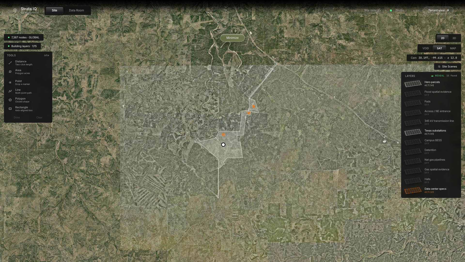
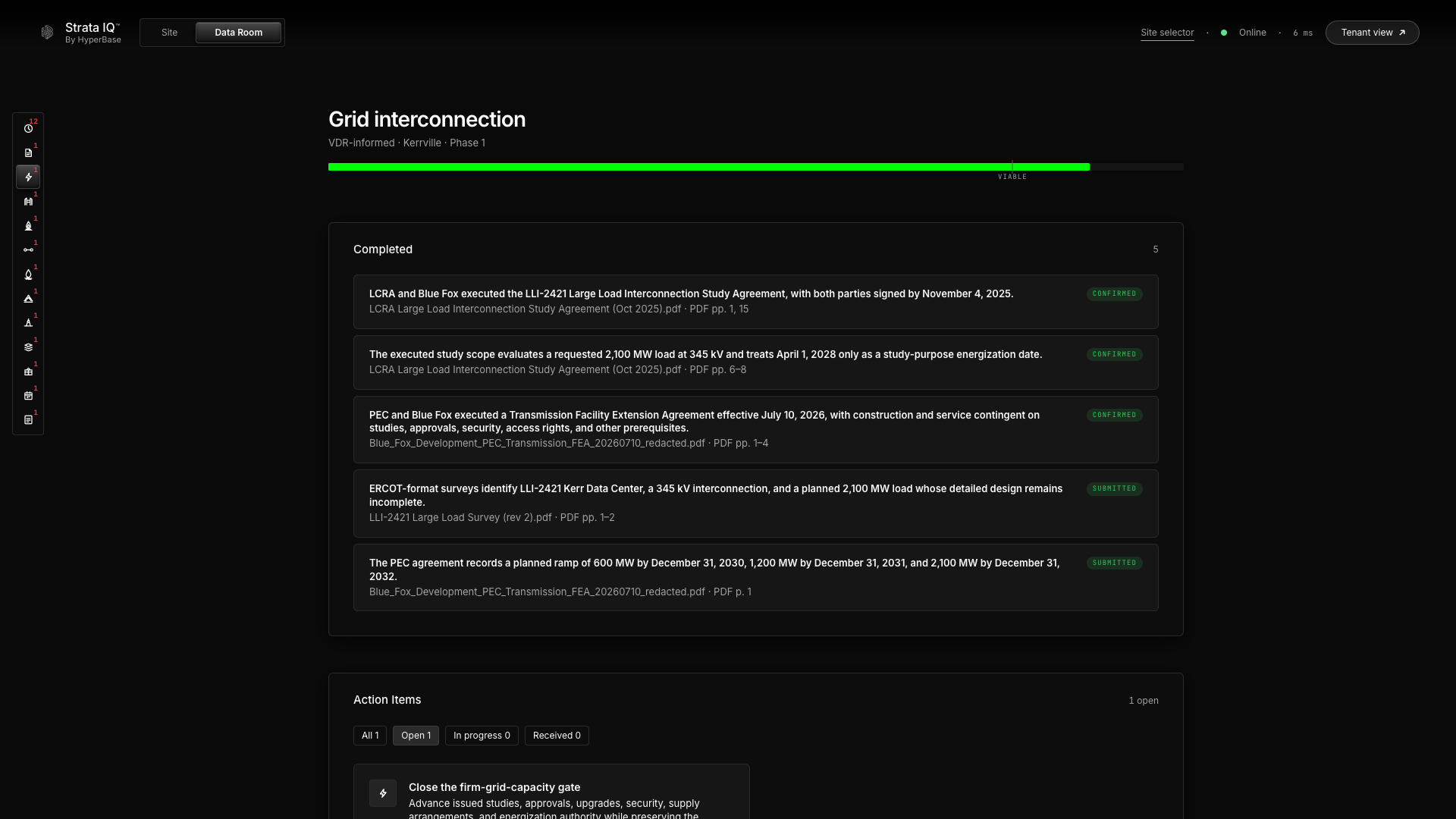
Source: Esri, Vantor, Earthstar Geographics, and the GIS User Community. Live capture does not establish deployment-to-commit identity or complete loading/accuracy of every layer. Capture metadata and checksums: data/platform-captures.json.
ASCENDENTUnaltered application screenshots are separate from any editorial source-model rendering.
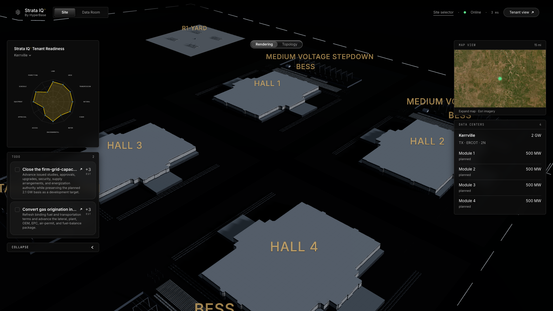
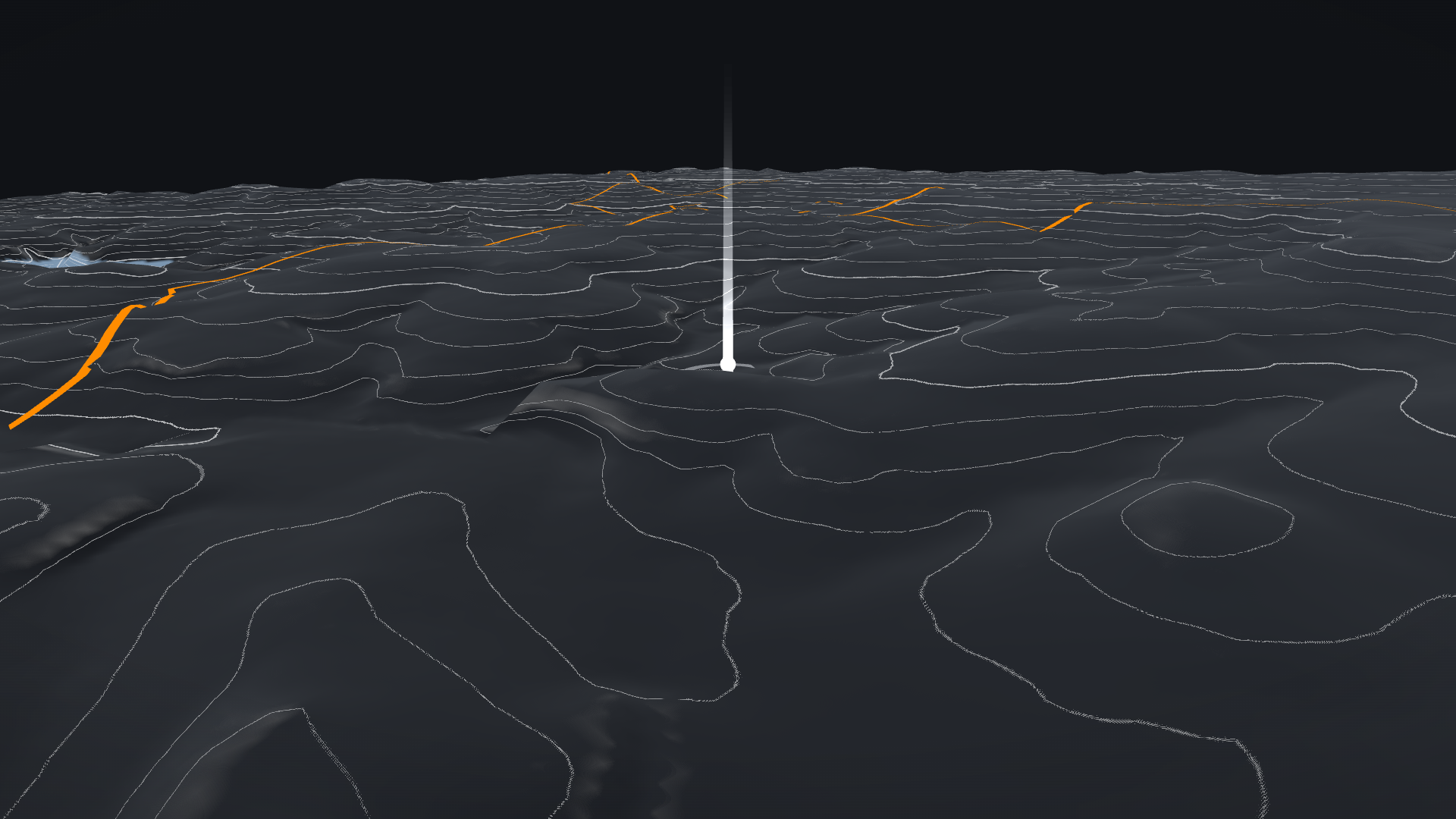
Source: Esri, Vantor, Earthstar Geographics, and the GIS User Community. Live capture does not establish deployment-to-commit identity or complete loading/accuracy of every layer. Capture metadata and checksums: data/platform-captures.json.
ASCENDENTArchitectural communication supports planning; it does not replace source evidence.
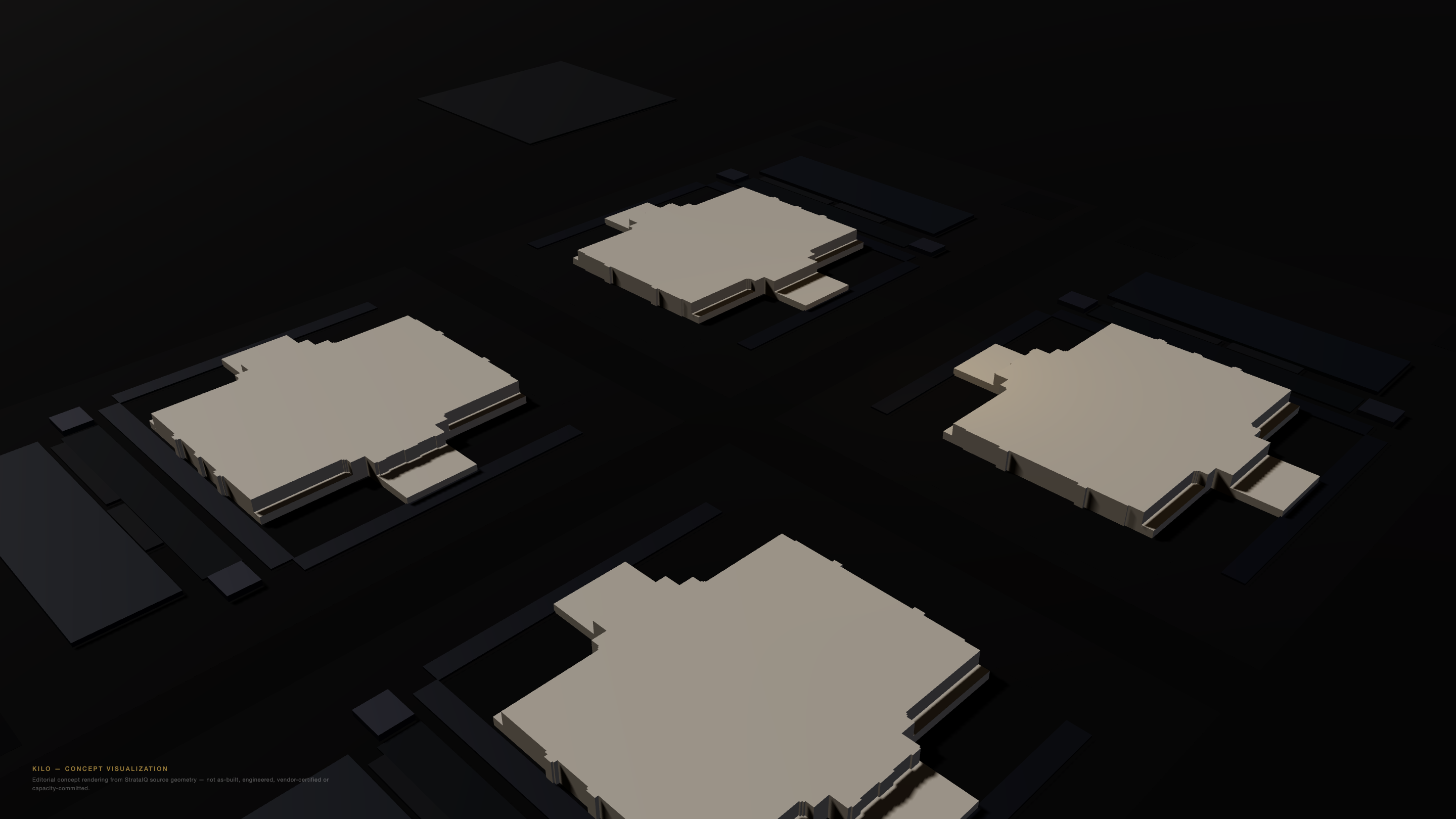
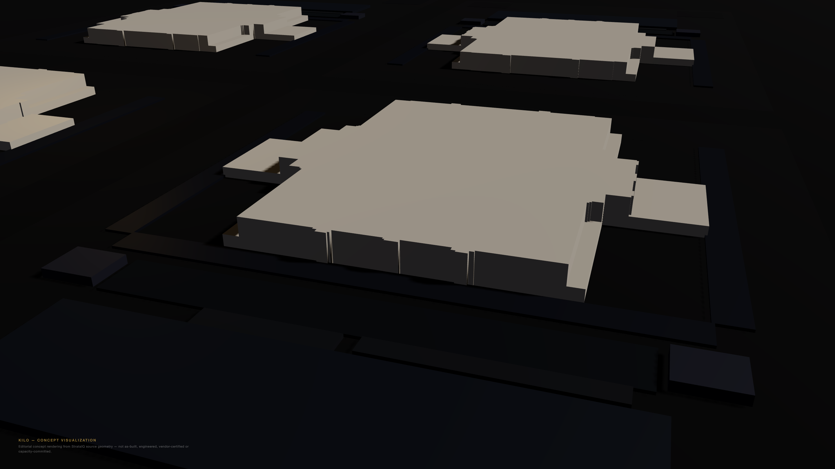
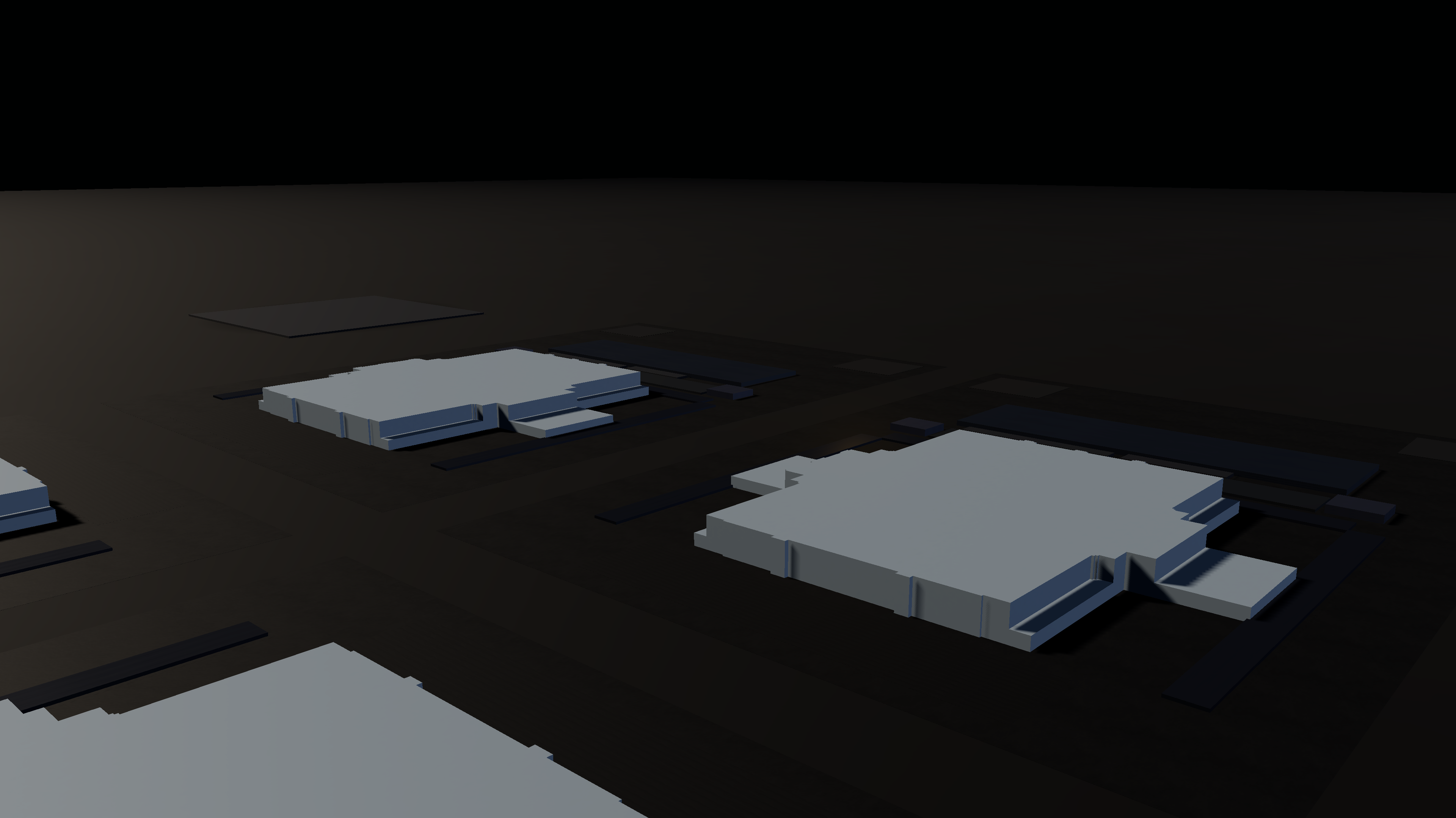
The native application captures and editorial concept renders are deliberately labeled separately. No capacity rating is inferred from the appearance or count of model modules.
ASCENDENT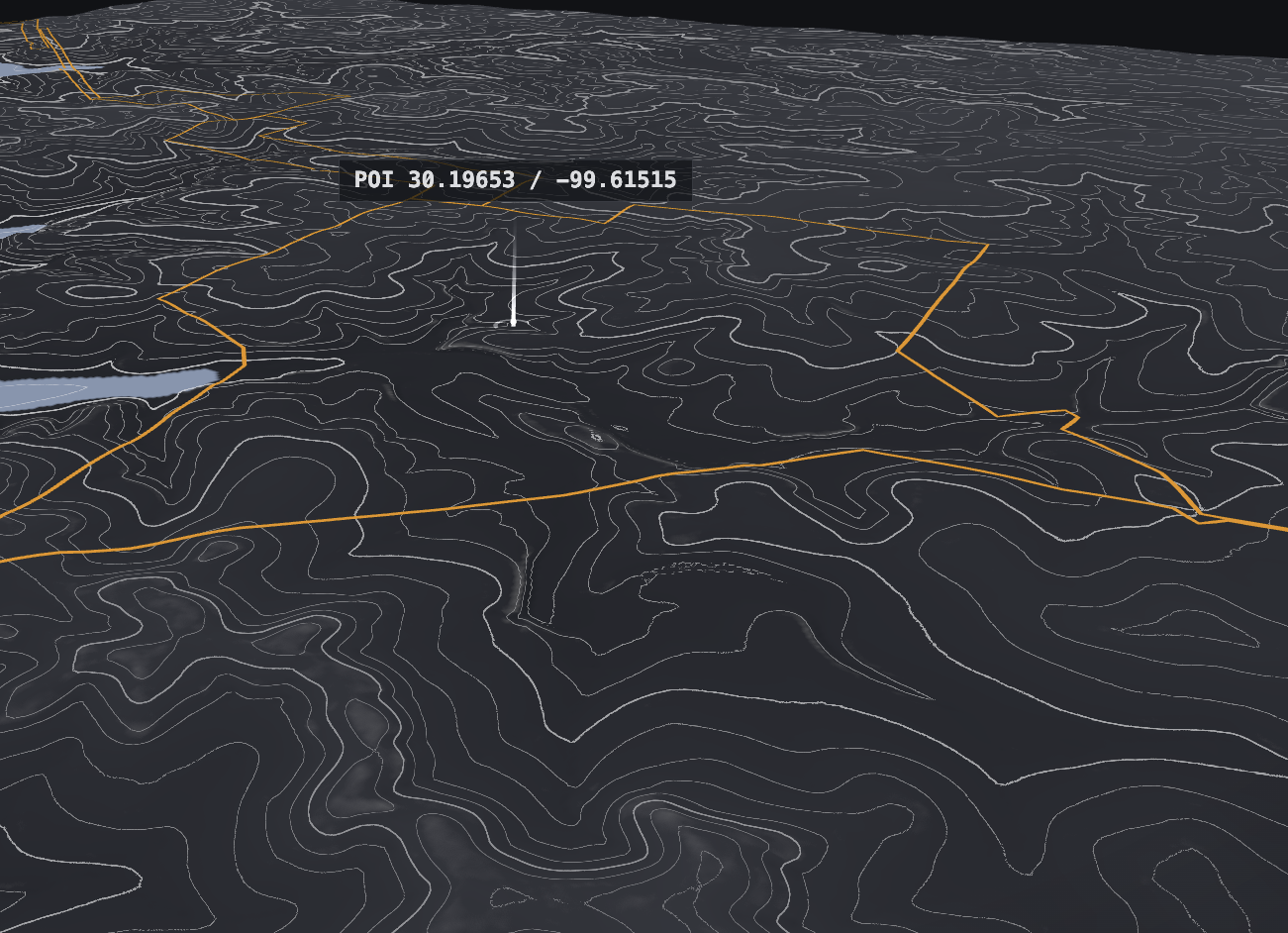
Screenshot 2026-09-15 at 15.59.57.png
Supplied screenshot of the contour/parcel/POI view. Markers and overlays are source-application representations, not an approved interconnection, survey or hazard determination.
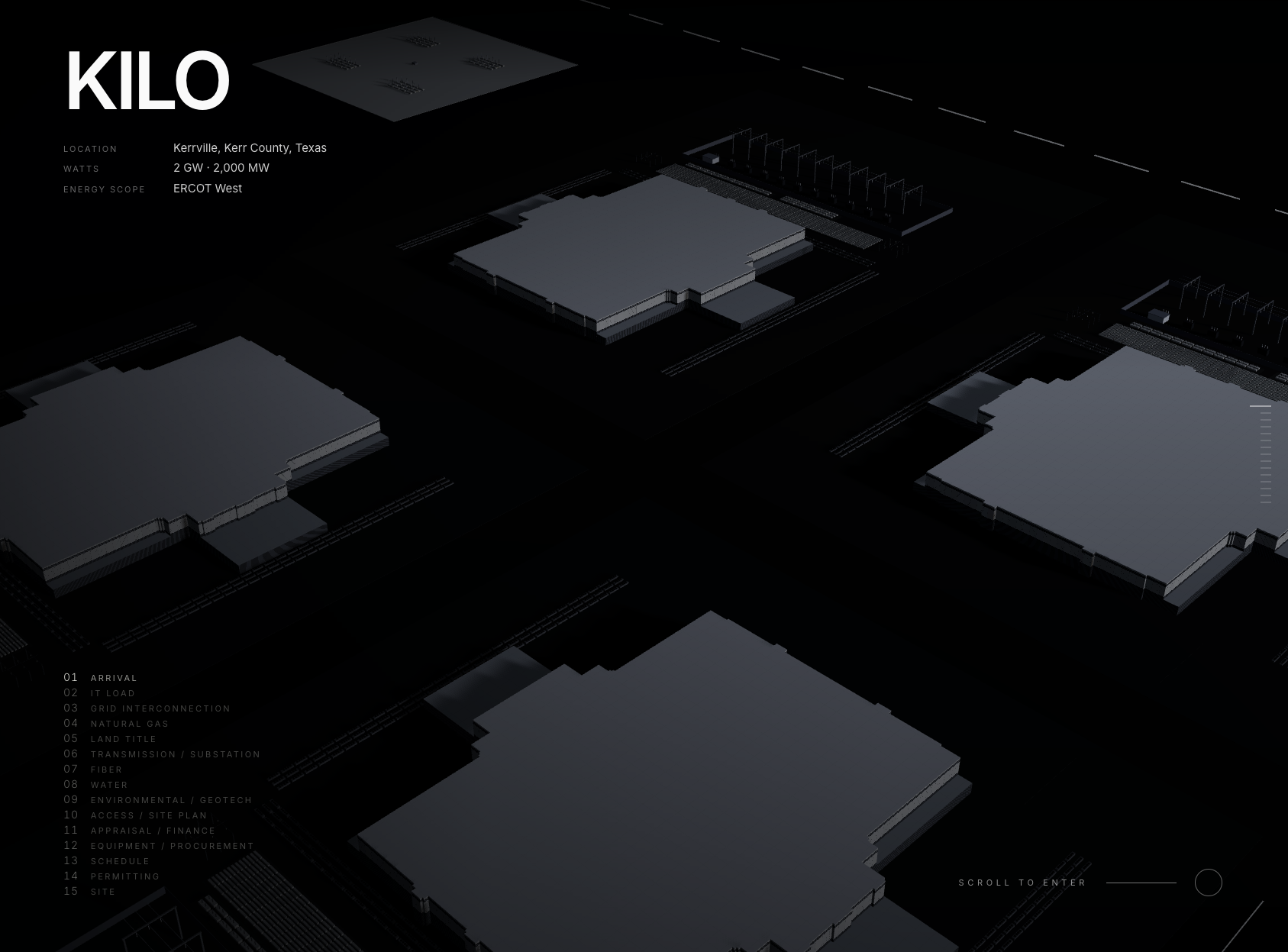
Screenshot 2026-09-15 at 15.56.51.png
Supplied native tenant-view concept-campus screenshot. The visible 2 GW / 2,000 MW label is an application planning value, not secured, installed or committed capacity; the diligence package retains the separate 2,100 MW study-request basis.
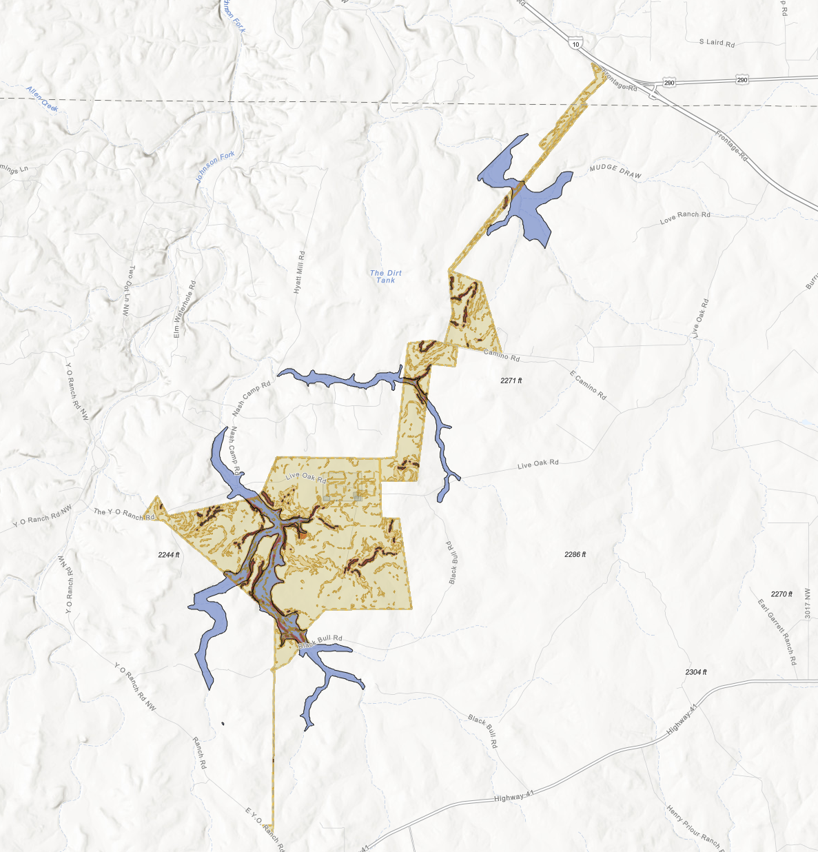
Screenshot 2026-09-15 at 15.55.11.png
Supplied topographic map with highlighted site extent and blue overlay areas. Legend, layer vintage and source geometry were not independently recertified from the screenshot; not an environmental clearance or a boundary survey.
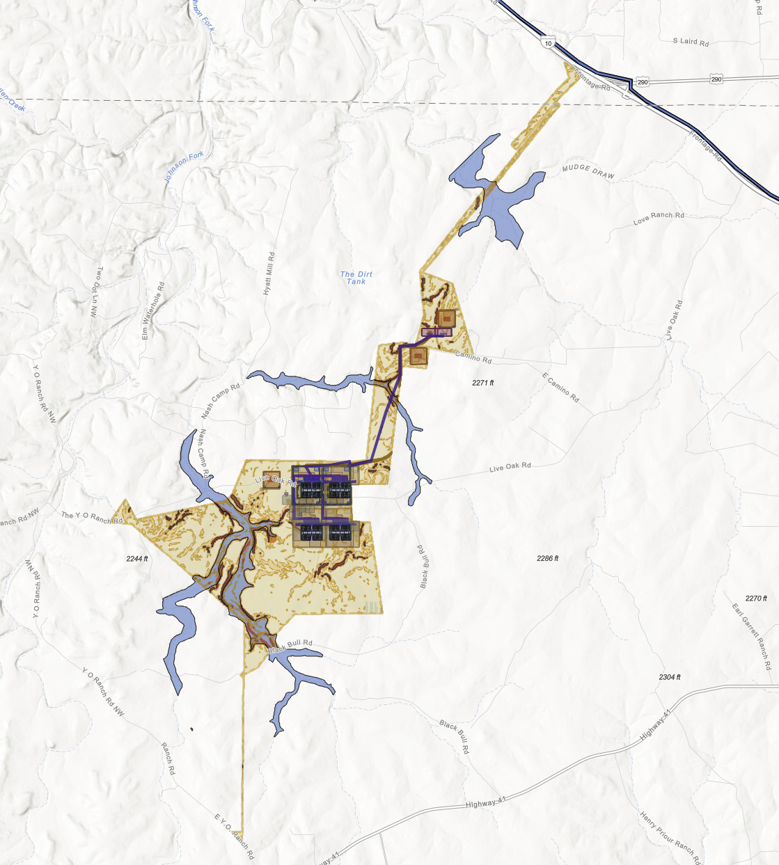
Screenshot 2026-09-15 at 15.54.24.png
Supplied topographic map with source-platform campus massing and corridor overlays. These are planning representations, not approved routes, contracted utilities, construction drawings or as-built assets.
All four originals are included without pixel edits. Full filenames, dimensions and SHA-256 values are in data/supplied-images.json. Filename times are retained as supplied, not independently authenticated capture timestamps. No new source-document certification or capacity finding is implied.
ASCENDENT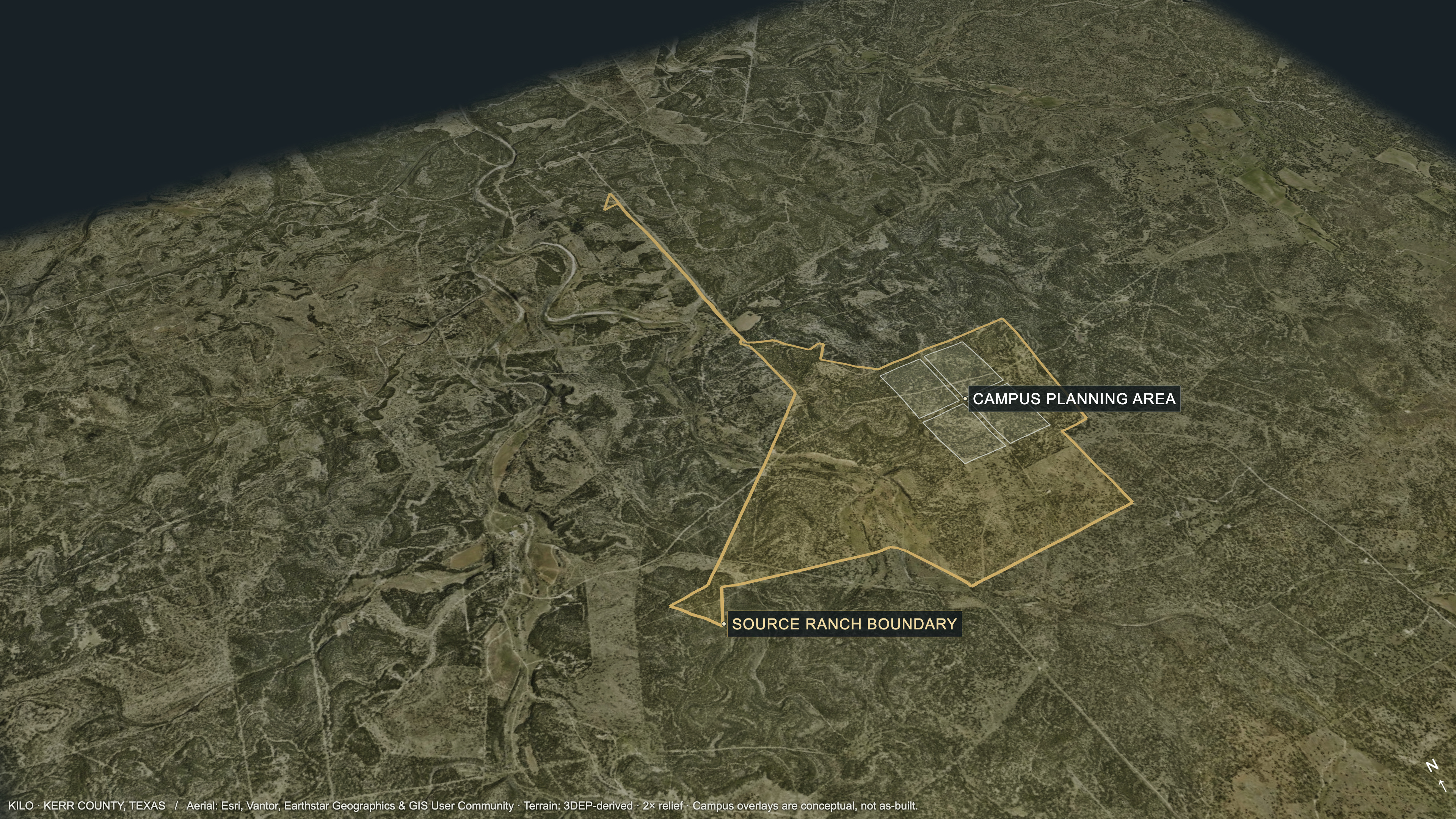
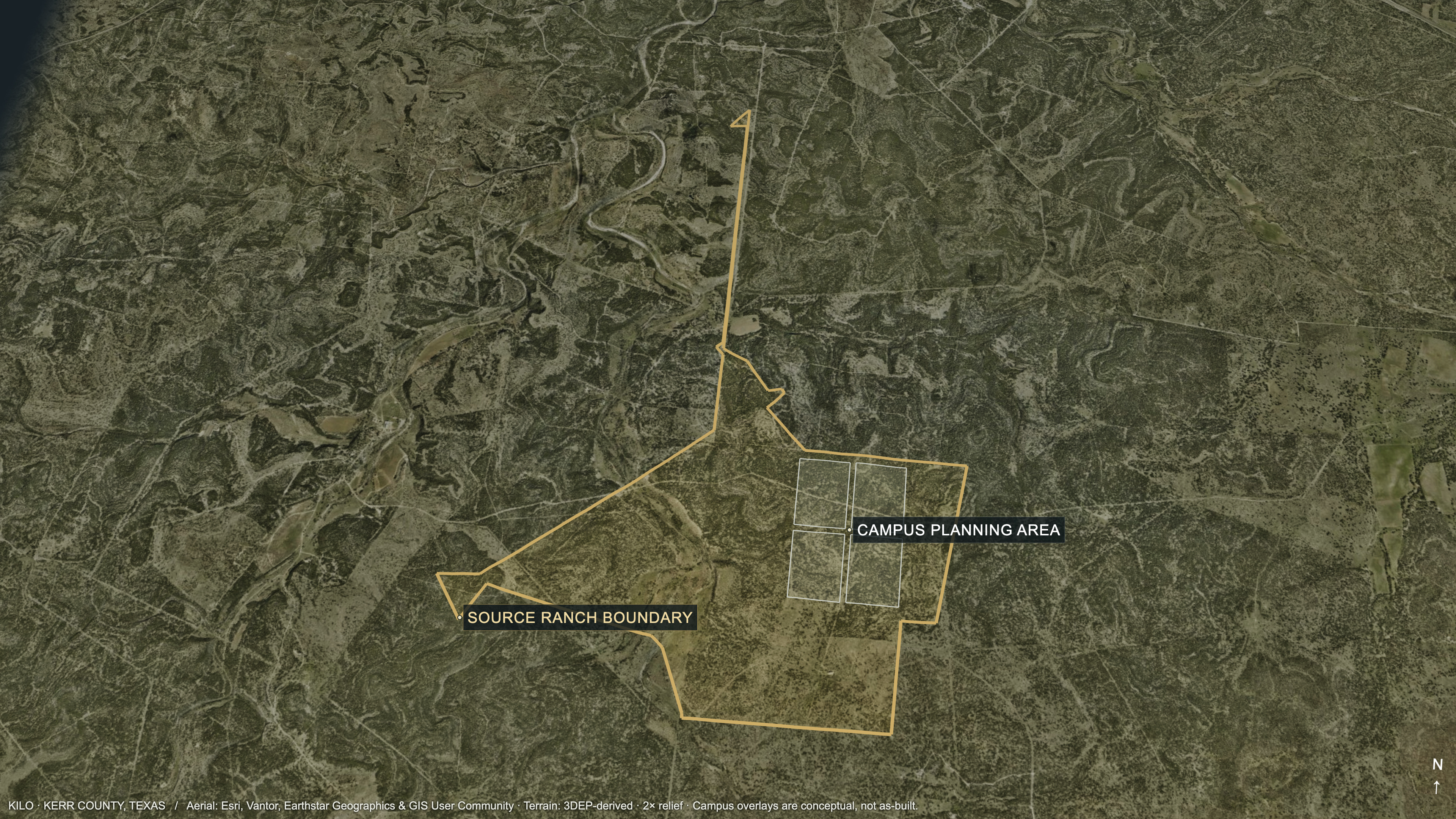
Geographic basis. World Imagery is draped over the source 3DEP-derived DEM using the returned EPSG:3857 image extent. The geographic hero uses 2× vertical display exaggeration. The source deeded-ranch outline is prominent; imagery fetch time is not an acquisition date.
Campus context. Four source planning-pad outlines are projected onto the terrain as conceptual overlays. No data-hall meshes appear in the new hero. This does not establish grading, buildability, approved parcels or as-built facilities. Other source maps and original screenshots are retained unchanged.
Model / evidence snapshot: HyperJD/strataiq-frontend · feature/kilo-improvements @ 85ad9bfa5a688048e292f3fe8d0fcf9afc15afd6. Geographic inputs, imagery extent, source hashes and camera parameters: data/site-hero-provenance.json. Imagery: Esri, Vantor, Earthstar Geographics & GIS User Community. The earlier rendering record remains in data/enhanced-renders.json; the live application is unchanged.
ASCENDENTA clear starting point for scoped diligence and tenant alignment.
Engagement pathway proposed by Ascendent. Not a notice to proceed or a commitment of capacity, price or delivery date.
Source branch: feature/kilo-improvements
Repository: HyperJD/strataiq-frontend
85ad9bfa5a688048e292f3fe8d0fcf9afc15afd6
Snapshot retrieved September 15, 2026. The authored analysis is retained with its document/page labels and open gates. Stored readiness values carry their own earlier source date.
This package is for evaluation and controlled diligence. It does not constitute legal, engineering, valuation, financing or certification assurance. Any reliance should be governed by the current originals and applicable definitive agreements.