
REV · 3.1 · 2026.09.16
CLASS · CONFIDENTIAL — SUBJECT TO CONTRACT
Kilo.
Your campus-scale AI site in Kerr County: surveyed land, executed LCRA and PEC instruments, and a 2,100 MW / 345 kV study path. Firm capacity is the next utility workstream — not a reason to wait on the conversation.
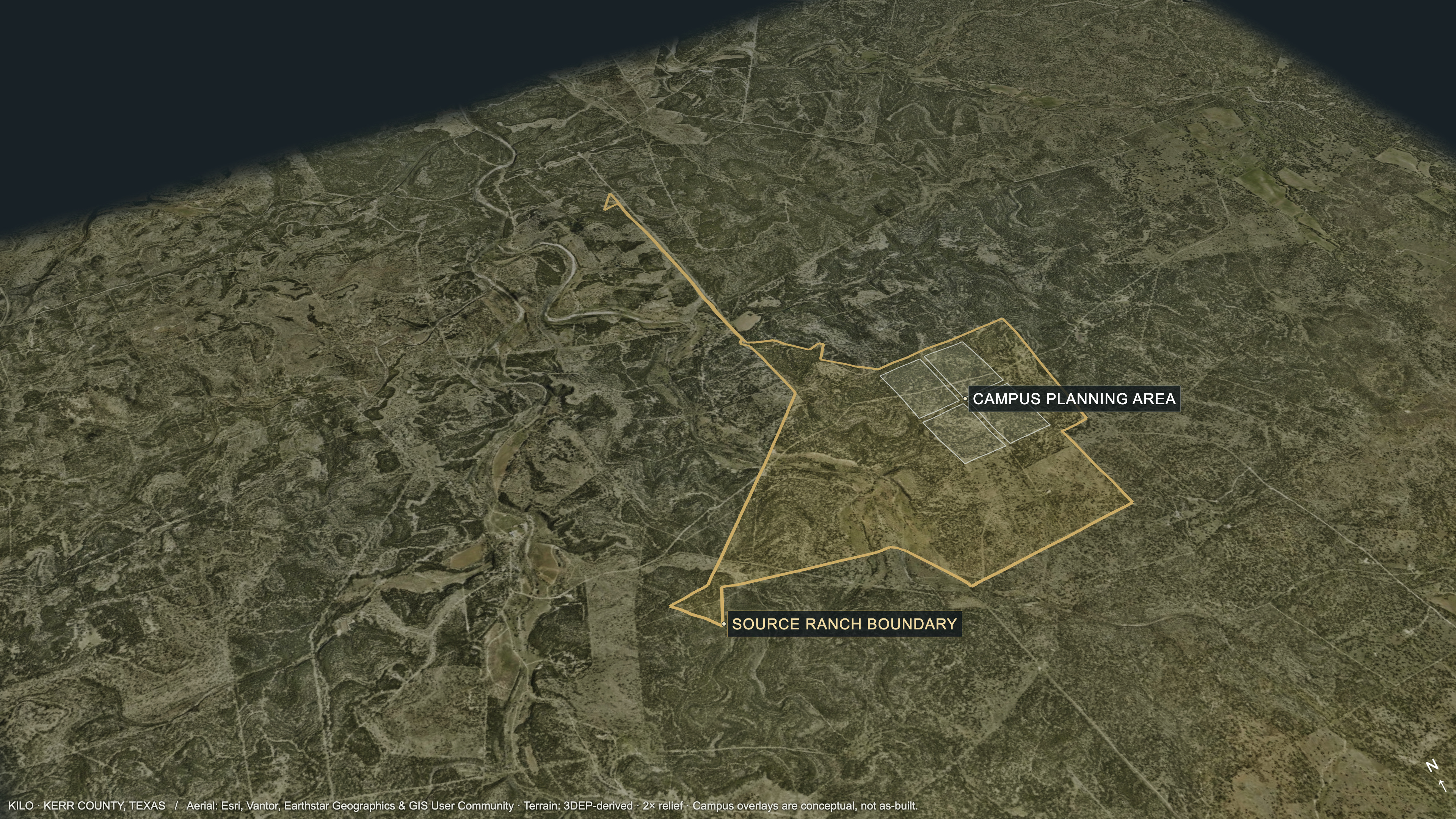
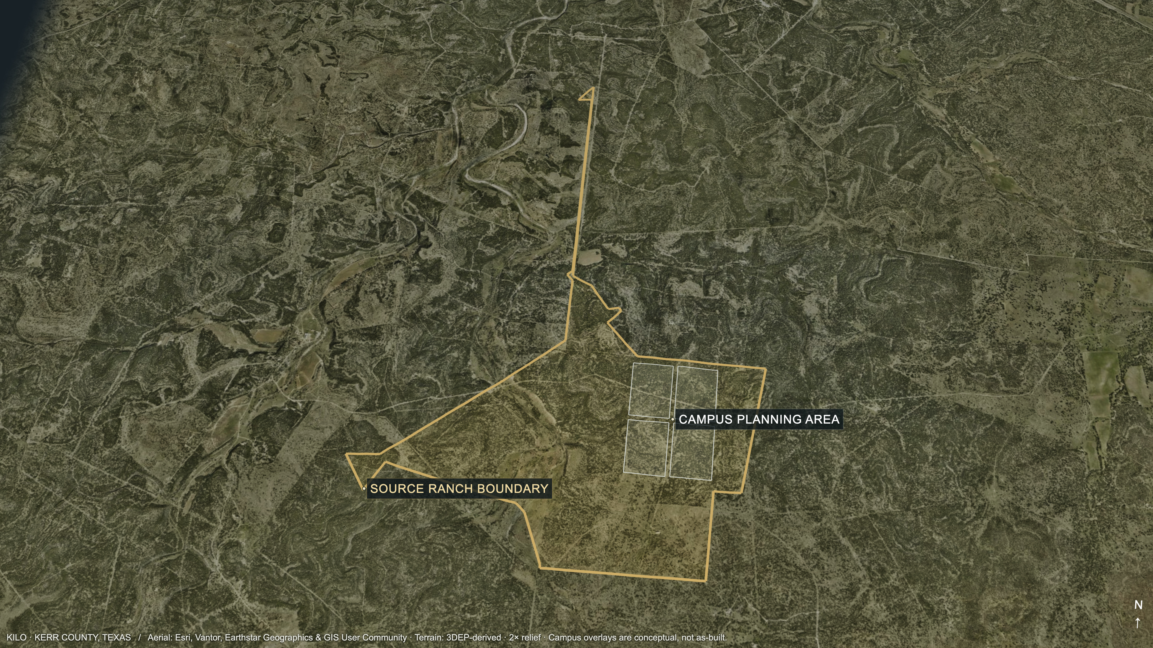
Kerr County, Texas · Aerial imagery + source terrain (2× relief). Source ranch outline and conceptual campus zones; not a survey or as-built record. Imagery: Esri, Vantor, Earthstar Geographics & GIS User Community.
Four chapters. One campus conversation.
How to walk the site with your team.
REV · 3.1 · 2026.09.16
CLASS · CONFIDENTIAL — SUBJECT TO CONTRACT
Your campus.
Land, access, and the ground you would take.
You start with a recorded tract, access on the instruments, slope-screened hall area, and a Phase I with no recognized environmental conditions on its stated scope.
This is Kilo, in Kerr County.
The campus card your team will brief against.
This campus sits in Kerrville, Kerr County, on ERCOT West at 345 kV. The hall-planning card is 4 × 500 MW (2,000 MW). The utility study request is 2,100 MW. Both are planning figures — the workstream is to make them real against your load.
You have a deed and a surveyed campus tract.
Land control you can brief. Three acreage scopes stay separate.
A recorded deed and title survey give you a campus you can plan. The survey is 3,979.63 acres. Deed, Phase I, and appraisal used different scopes — we keep them labeled. Title-close work is a tenant workstream, not a missing campus.
- Deed to Blue Fox Development, LLC. Authored status: confirmed. [land-01] [L1]
- Deed acreage: 3,980.63 gross acres less a 1.00-acre exception. Kerr County Document 24-02602. [land-02] [L1]
- Title survey: 3,979.63-acre tract, with record access, telephone, and water-related easements. [land-03] [L1]
- Phase I ESA scope: 24 adjoining parcels totaling approximately 4,005.86 acres. Different scope. [land-04] [L1]
- Appraisal used a 4,500-acre premise — a third scope. We do not combine it with the survey, and we do not lead with appraisal numbers. [land-m02] [finance-01]
Access is on the instruments. There is room for halls.
Recorded access, plus slope-screened area for campus layout.
You have recorded access and conceptual campus geometry. Slope screens are a planning start — we engineer pads, drainage, and the master plan as the next site workstream.
- YO Ranch Road strip: 60 ft wide, 16.33 acres. Authored status: confirmed. [access-01] [L1]
- Title survey: 60-foot private-access easement. Authored status: confirmed. [access-02] [L1]
- Conceptual geometry: five KML polygons, six-hall schematic, slope maps. Authored status: submitted. [access-03] [L1]
- Slope screening: 3,514.1 acres under a less-than-10-percent criterion; 3,109.4 acres under less-than-5-percent, avoiding mapped FEMA and wetland areas. Submitted. [geo-02] [L1]
ASCENDENTSee the ranch. See the campus.
Campus on the landform
Closer on the planned halls
Phase I is done on the stated scope.
No recognized environmental conditions on the Phase I scope. Field and design studies are the next site workstream.
The January 2026 Phase I reported no recognized environmental conditions on its 4,005.86-acre, 24-parcel scope. Targeted geotech, karst, and layout studies are the next workstream as halls land.
- Phase I ESA: no recognized environmental conditions on the stated 4,005.86-acre, 24-parcel scope. Confirmed. [geo-01] [L1]
- Groundwater-prospecting report describes the surveyed area as primarily Edwards Limestone Formation. Submitted. [geo-03] [L1]
- Next design gate: targeted geotechnical and karst investigation for halls, power facilities, roads, substations, and corridors. [geo-m01] [gap-environmental-stage]
- Also remaining as layout matures: wetlands and waters, parcel flood and drainage, species, cultural, air, and noise work. [geo-m02] [L1]
REV · 3.1 · 2026.09.16
CLASS · CONFIDENTIAL — SUBJECT TO CONTRACT
How power gets to your halls.
Grid path, on-site generation, water, and fiber.
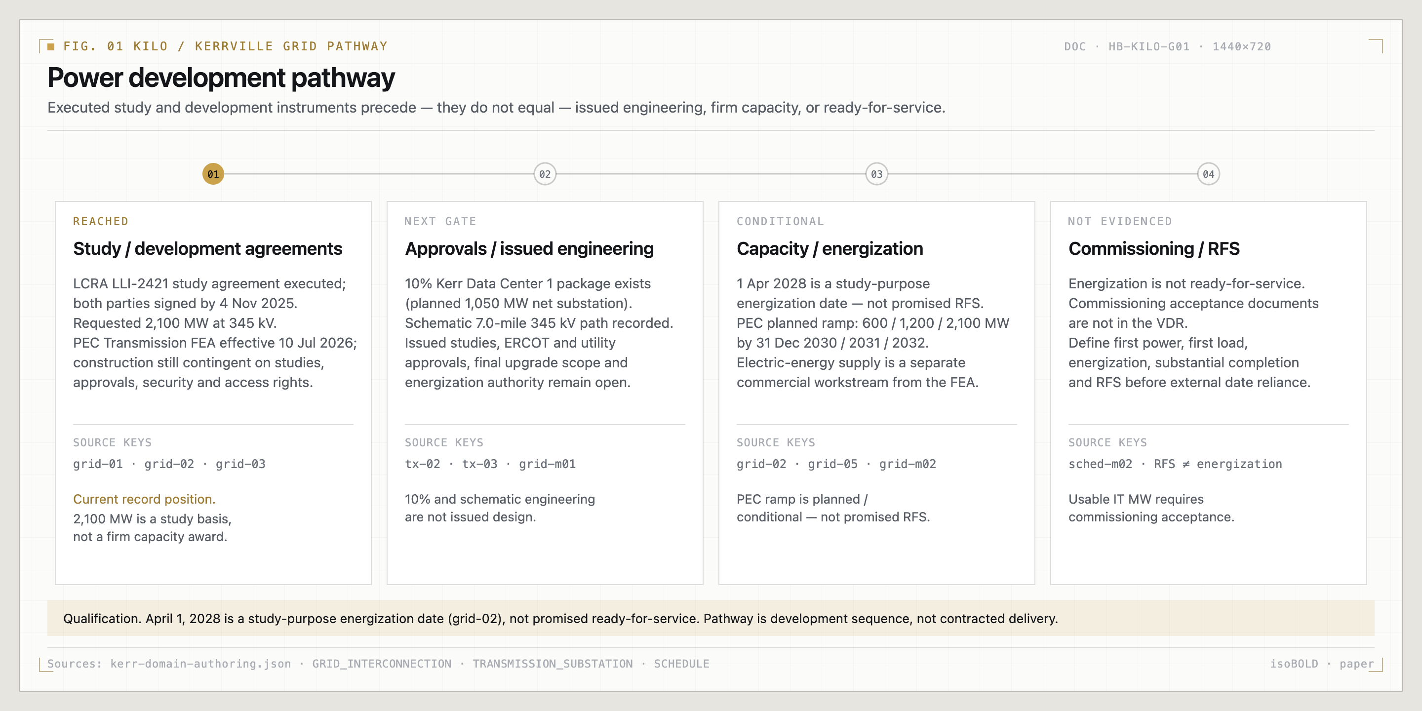
You already have executed study and facility instruments and a first-cut engineering path. The 2,100 MW / 345 kV figure is the study basis. We close supply, firm capacity, and energization with your load case.
Two proposed points on LCRA 345 kV.
A 10% substation package and a schematic corridor. Issued design is the next engineering workstream.
The LCRA study names proposed points on Big Hill–Kendall 345 kV. A 10% substation package and a schematic 7-mile corridor are already in file. Rights, the I-10 crossing, and issued design are the work we do next.
- Two proposed POIs on LCRA-owned Big Hill–Kendall 345 kV circuits. Confirmed. [tx-01] [L1]
- 10% package: preliminary 345/34.5 kV single-line, general arrangement, site plan, and equipment for a planned 1,050 MW net substation. Submitted. [tx-02] [L1]
- Schematic plan: proposed 7.0-mile 345 kV path, one I-10 crossing, a midpoint PEC tie, and an on-site switchyard. Submitted schematic, not surveyed ROW. [tx-03] [L1]
A 1,105 MW on-site generation path.
A Phase 1 generation path you can design against. Binding fuel is the next commercial workstream.
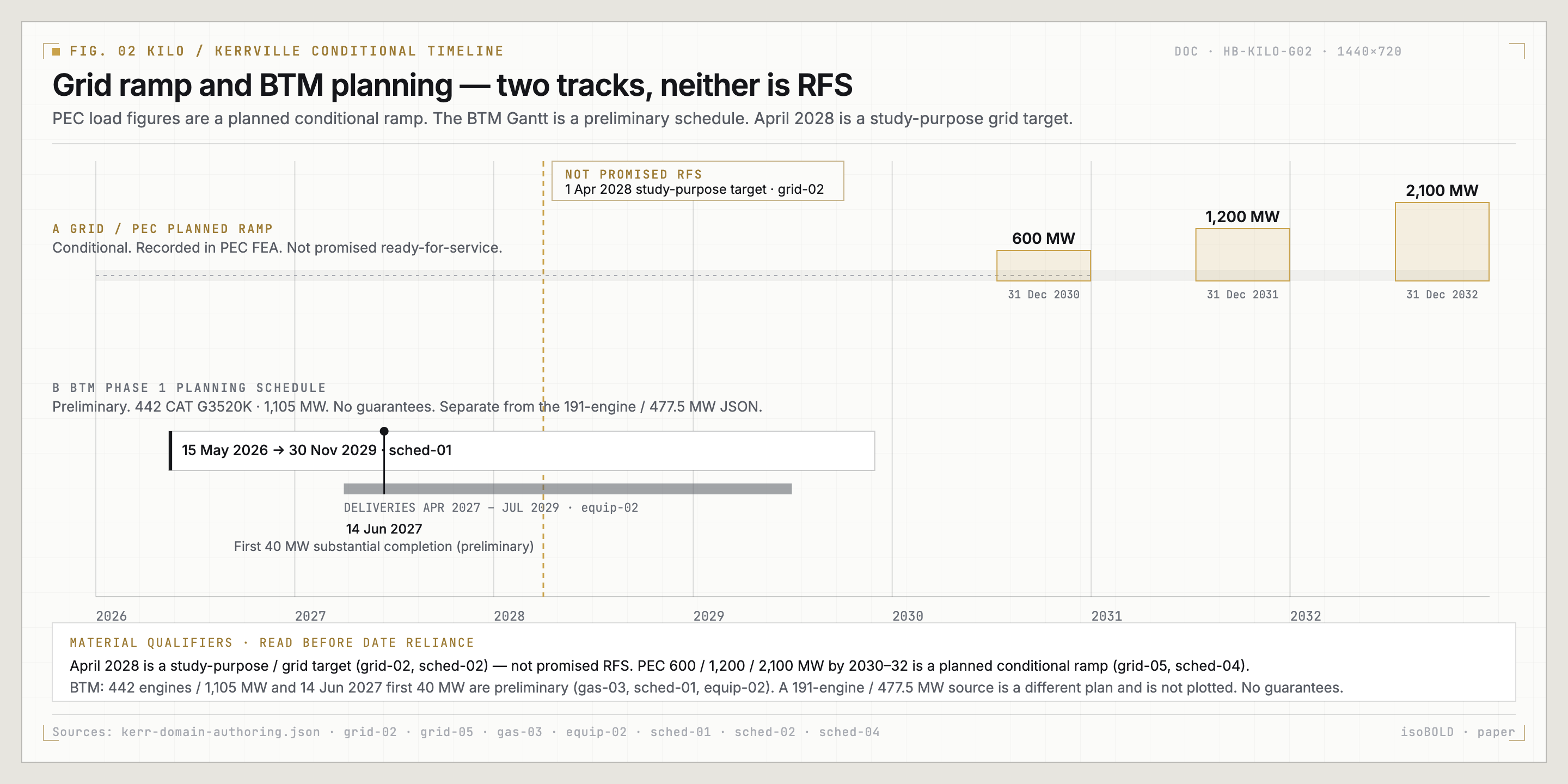
You have a gas origination path and a preliminary Phase 1 plan: 442 CAT G3520K engines totaling 1,105 MW. Binding fuel, the lateral, and plant commitments are the work we close with you. Planning figures are not installed kit.
- Kinder Morgan proposed firm transportation of up to 215,000 MMBtu/d to a new Kerr County delivery point for a 10-year term after meter in-service. Submitted. Not a binding contract. [gas-01] [L1]
- Proposal contemplates a new lateral and interconnect, with receipt and delivery points still to be determined. Submitted. [gas-02] [L1]
- Preliminary Phase 1 schedule: 442 CAT G3520K engines totaling 1,105 MW through July 2029, deliveries April 2027 through July 2029. Submitted. [gas-03] [equip-02]
- Supporting Ascendant Energy JSON, kept separate: 191 CAT G3520K engines, 477.5 MW nameplate. Not interchangeable with the 442 / 1,105 MW schedule. [L5]
Water, fiber, and permits already have a path.
The file already names the next wells, the nearby backbone, and the agency path.
Water
Well-quality testing and a 24-location prospecting program define a source-development pathway.
Drill and pump-test priority targets; establish rights/permits and the phased water/wastewater balance.
Fiber
The Kerr Summary reports a 48-strand LCRA backbone about 0.11 mile / 600 feet from the northern boundary.
Confirm allocation or IRU terms, surveyed laterals, latency and physically diverse end-to-end routes.
Permitting
Rural land-use context and a planned TCEQ air-permit workstream identify the agency pathway.
Maintain a complete permit register, current application status and agency correspondence tied to the schedule.
Well tests and interpreted groundwater are a source program, not a supply guarantee. Backbone adjacency is the start of a fiber contract. Planned applications still have to be filed and issued — that is the permitting workstream. Source [1] · water-01/03, fiber-01, permit-01/02.
REV · 3.1 · 2026.09.16
CLASS · CONFIDENTIAL — SUBJECT TO CONTRACT
See the campus.
Map, concept, and readiness.
These views put the tract, the campus concept, and the stored readiness snapshot in front of your team.
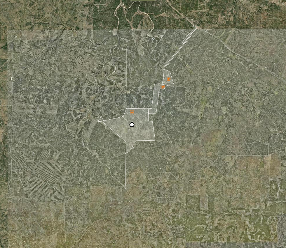
Your tract, on the map.
Start here when you want to see the land.
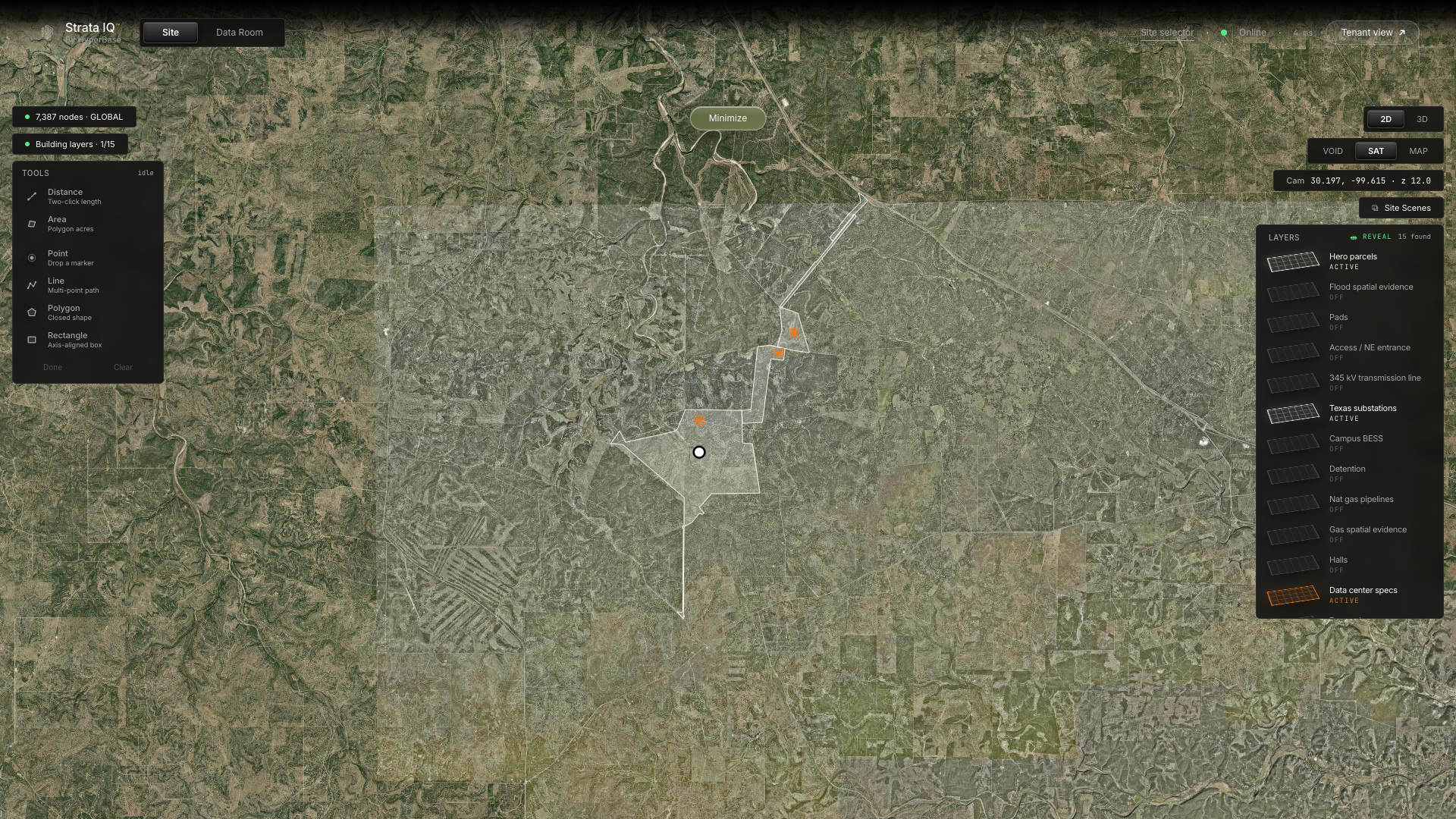
Overlays are platform representations, not a survey replacement. Basemap: Esri World Imagery.
Twelve domains. One campus file.
What is in hand, and the next action in each domain.
Confirmed and submitted are file statuses. Use the annex when you want the citation behind a sentence.
Source [1] · Complete authored domain record
ASCENDENTHalls on the landform.
Campus concept
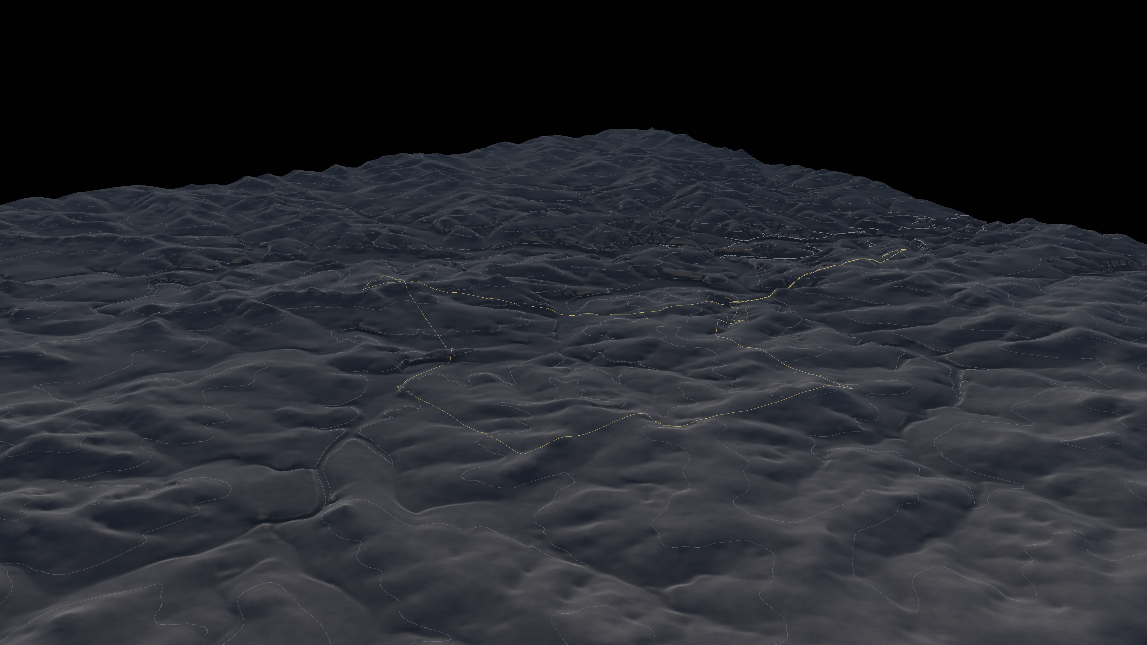
The Kerr County setting
 ASCENDENT
The setting your campus occupies.
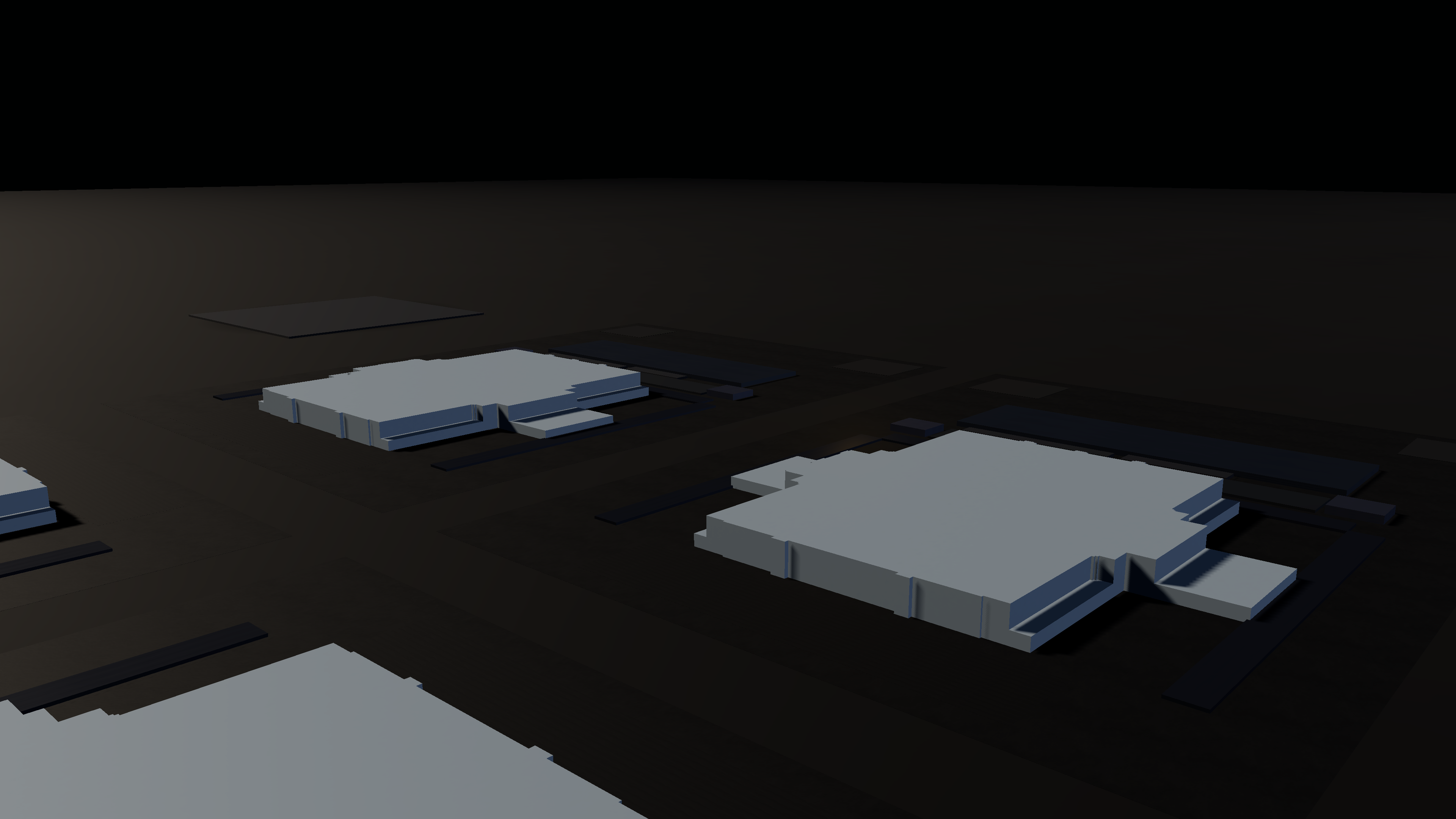
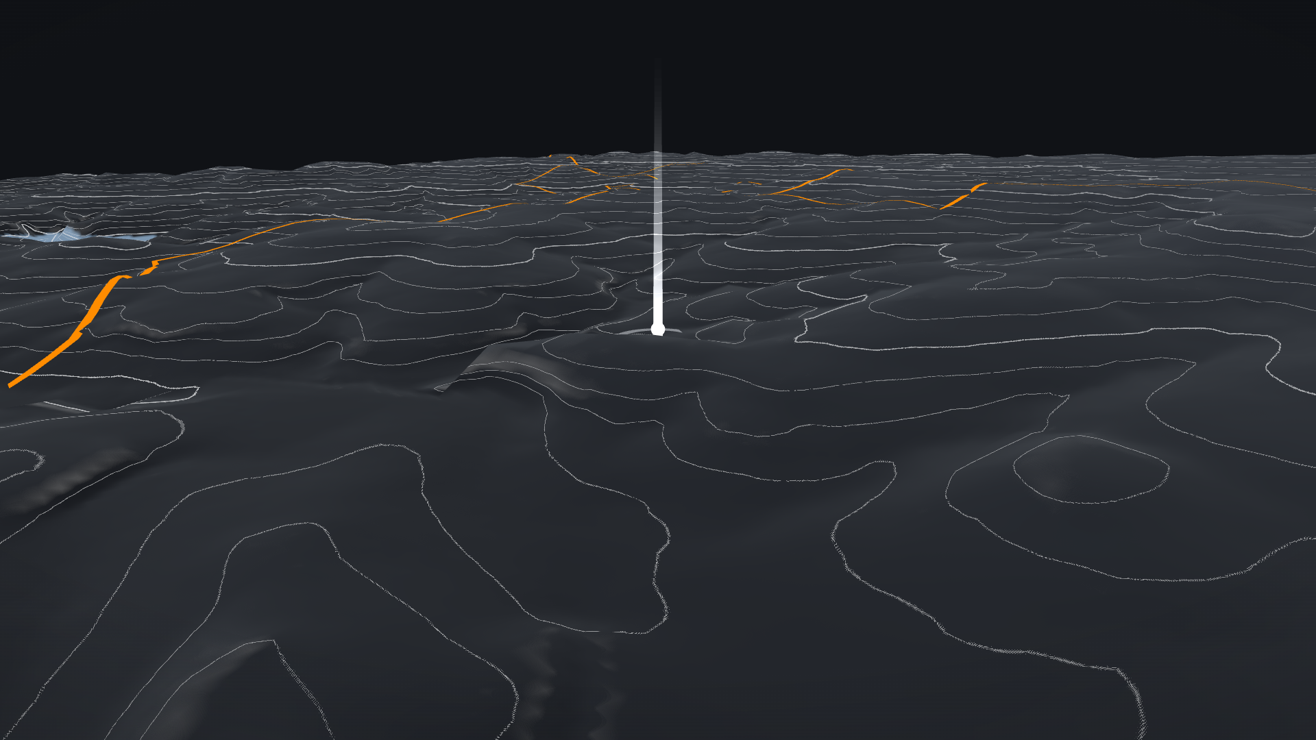
Campus at dusk
The landform
Campus readiness, shown in full.
A planning snapshot for this campus — not a ranking of other sites.
Planning score for this site.
Not a market ranking.
17 in hand / 30 in motion / 12 next
The stored campus snapshot is 85 / Viable, dated 2 September 2026. All seven categories are shown. These are planning scores for this site, not an independent rating or a comparison set.
REV · 3.1 · 2026.09.16
CLASS · CONFIDENTIAL — SUBJECT TO CONTRACT
From this campus to a scoped next step.
How we work with your team on this site.
The file is ready for a tenant conversation. Bring your requirements. We close the remaining workstreams with you — and we do not treat the study basis as power already in the building.
A buffer between generation and the halls.
Containerized storage is the flexible-capacity story — not a committed megawatt-hour award.
Storage sits between generation and the halls so you can buffer and shape load. Blocks can land as the campus grows. This is how the site can work — we do not invent a storage award or a ready date.
The work we do with you.
Named workstreams. The full action list lives in the source annex.
These are the workstreams we run with a tenant — grid, fuel, title, corridor, water, fiber, and one governing schedule.
- Close the firm-grid-capacity gate. Site-page todo. [gap-grid-stage] [L1]
- Convert gas origination into execution. Site-page todo. [gap-gas-stage] [L1]
- Complete title-close diligence. Site-page todo. [gap-title] [L1]
- Advance corridor and substation to issued design. Site-page todo. [gap-transmission-stage] [L1]
- Prove the phased water pathway. Site-page todo. [gap-water] [L1]
- Convert fiber adjacency into contracted resilient service. Site-page todo. [gap-fiber-stage] [L1]
- Designate the governing integrated schedule. Site-page todo. [gap-master-schedule] [L1]
Twelve domains. One next step each.
Each domain already has a named next step. Claims, notes, and citations live in the source annex.
We keep each source on its own terms.
Open workstreams and files that do not yet agree. Not a failure report.
When two files disagree, we show both. Use the campus brief with the originals, the variant register, and the remaining requests.